Contributed by Michael Horgan, Director of Sales, Introspective Systems
Drone usage for commercial applications is exploding at this moment, and there are many interesting applications for business on the horizon. Some of the main drivers for the adoption of drones include human safety, reduction in costs, and the ability to use data analysis in conjunction with aerial photos to gain a better understanding of the physical world. At Introspective Systems, our collaborative AI platform has a variety of ways to help drones collect data in a more efficient way as well as to pull together data of the likes of historical weather information, aerial photographs, and geophysical information into a usable decision-making format.
Our interest in drones led me to attend the Drone Applications for Business conference at the University of Maine in Augusta earlier this month. This conference balanced providing information about the different types of drone applications and with relevant information about running a drone business, including regulatory, insurance, and legal issues.
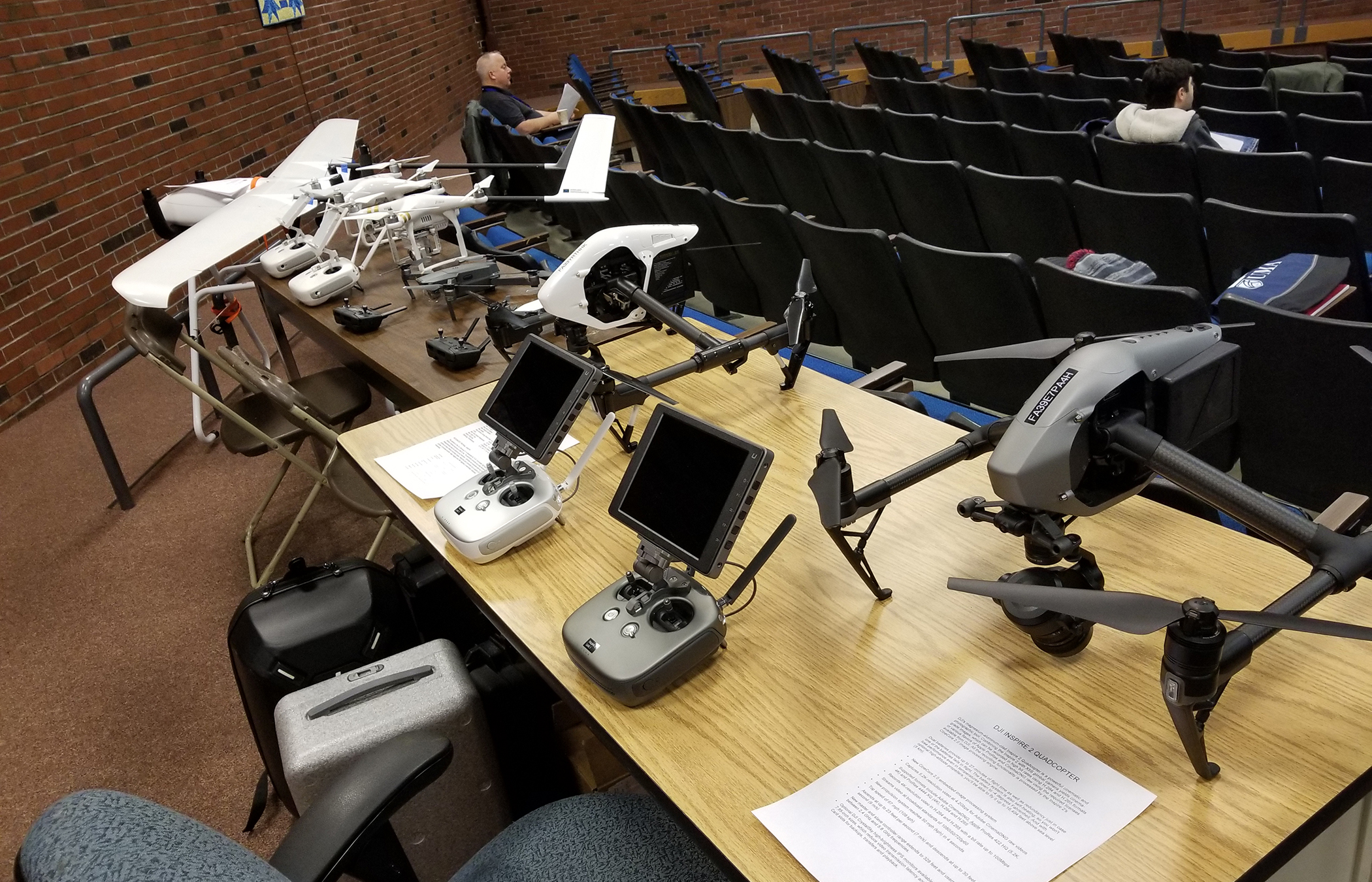
The University put on a great display of available drones, from the 12-foot fixed-wing planes down to the small drones for indoor photo applications. It was great to get up close to these devices and see how they are made and learn about how they are operated.
One of the key statements of the conference was the need for qualified drone pilots for these business opportunities — industry analysts expect 100,000 new jobs in this field within the next seven years. University has responded to this need by creating several courses focused on drone operations.
The Federal Aviation Administration has set strict guidelines for the commercial use of drones: they are restricted to flying within daylight hours, they must stay in the line of sight of the controllers, and cannot operate over people not involved in the activity that the drone is supporting. The FAA can grant some waivers from these rules, depending on the need.
The speakers mentioned many applications where drones provide greater efficiency of time and safety. Some of the applications remove the need for people to reach dangerous places such as inspections of bridges, towers, roofs, and statues. During the last year, I have noticed an improvement in how long traffic is stopped on the highway due to accidents and was surprised to hear that this was due to the use of drones for surveying and collecting data on the crashes. It has reduced the time for data collection from approximately three hours to less than 30 minutes.
Drones have been used for a while now to take pictures to complement land surveys and document soil erosion and civil engineering work. With the advent of new cameras, software, and other technology, the business opportunities, and applications for drones will take off in these markets.
I was particularly interested in the increased use of drones for precision agriculture and forest management. The drones are used both for surveying the land and identifying problems for localized crop treatment. The data from the drones can be combined with other data like the weather, type of seed, and soil quality to give the farmer a much better picture of how to manage the land more productively.
I left the conference with a real sense of excitement of the fabulous opportunities that are happening now and in the forthcoming years for using drones and drone data. And, of course, I am especially excited to fly these new drones.